
Junayed Habib
University of Middlesex, UK
Somewhere beneath our feet, the planet is quietly shifting its balance. NASA scientists at the Jet Propulsion Laboratory have refined a method for tracking Earth’s centre of mass, the point around which its gravitational pull is centered, finding it moves several millimetres yearly as water, ice, and air redistribute globally. Snow over North America nudges it northward each March, Amazon rainwater pulls it south each April, and Southeast Asian monsoons add their own tug each November.
This sounds like abstract geodesy, but for a low-lying delta nation like Bangladesh, such precision measurement is not academic. It underpins every flood forecast, satellite elevation map, and attempts to understand how a country built on shifting river sediment will fare in a warming world.
A Country Defined by Water and Elevation
Bangladesh occupies the lower reaches of the Ganges, Brahmaputra and Meghna river system, one of the largest deltas on Earth. More than eighty percent of its land sits at or below ten metres elevation, with the southern coastal belt barely a metre or two above sea level, which is why the satellite measurement techniques in the NASA study, relying on Earth’s centre of mass to calibrate elevation data, matter so directly here.
Even small errors in that reference point can create meaningful discrepancies when mapping how close Bangladesh’s coastline sits to the rising sea. As sea level climbs, driven by the same mass redistribution NASA now measures more precisely, melting ice and shifting ocean water, the margin for error in predicting inundation becomes a matter of survival planning rather than scientific curiosity.
Rivers That Give and Take
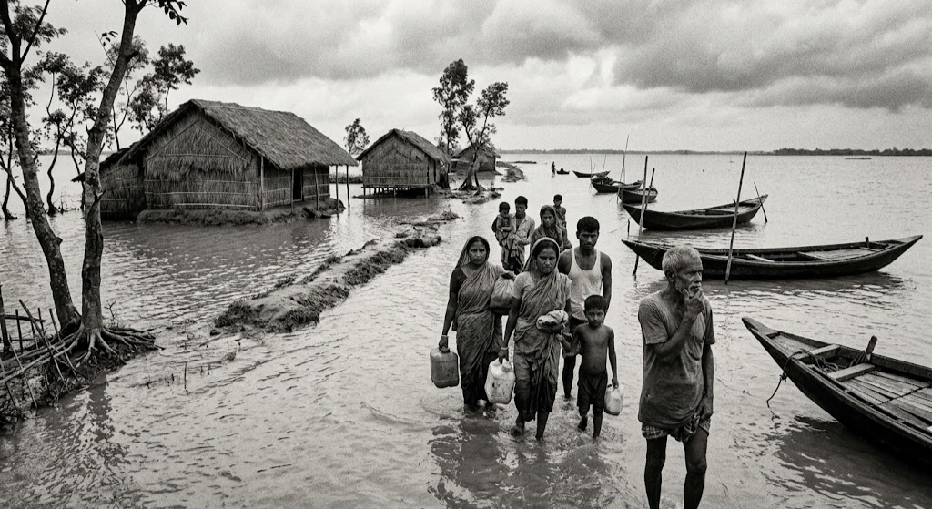
The three great rivers that built Bangladesh’s fertile plains are also its greatest source of seasonal upheaval. Each monsoon season, the same atmospheric moisture patterns that the NASA researchers tracked as contributing to Earth’s mass shifts, the roughly 600 gigatonnes of water tied to Southeast Asian monsoon systems, arrive over the Bay of Bengal and the Himalayan catchment, swelling the Brahmaputra and Ganges until they overflow their banks across the floodplains of Bangladesh. Flooding here is not an anomaly but an annual rhythm, one that has shaped agricultural cycles for centuries.
Yet the intensity and unpredictability of that rhythm are changing. Glacial melt in the Himalayas, altered monsoon timing linked to broader shifts in atmospheric mass and ocean heat content, and the sheer volume of sediment and water moving through the delta all interact in ways that improved satellite tracking, of the kind NASA has just refined, can help scientists model with greater confidence.
The Seismic Question Beneath the Silt
Bangladesh’s vulnerability is not confined to water from above. The delta sits near the boundary of the Indian and Eurasian tectonic plates, close to a subduction zone capable of generating major earthquakes. Studies over the past decade have pointed to significant strain accumulation beneath the region, raising concern about a large seismic event whose full impact remains difficult to anticipate precisely because the soft, saturated sediment of the delta amplifies ground shaking in ways that differ from harder bedrock elsewhere.
The kind of high precision geodetic tracking NASA scientists use to detect millimetre scale shifts in Earth’s mass distribution is drawn from the same scientific toolkit, satellite laser ranging, GPS networks and crustal deformation monitoring, that seismologists use to watch for the slow strain building along fault lines. Better global reference systems make it easier to detect the tiny ground movements that often precede larger tectonic events.
Harvests, Soil and the People Who Depend on Both
The same rivers that threaten Bangladesh with flooding are also the reason its soil ranks among the most fertile on Earth. Annual flooding deposits nutrient rich silt across the floodplains, sustaining rice, jute and vegetable cultivation for a population exceeding 170 million living on a landmass smaller than the state of Illinois. This fertility, however, is a delicate balance. Excessive or poorly timed flooding destroys standing crops rather than nourishing future ones, while rising sea levels pushes saline water further inland through tidal rivers and groundwater, gradually degrading soil quality across the southwestern coastal districts. Salinity intrusion has already forced farmers in parts of Khulna and Satkhira to abandon rice cultivation in favour of shrimp farming, a shift with its own ecological costs. Meanwhile, population density in a shrinking habitable zone intensifies pressure on the very land that feeds it, a demographic and environmental squeeze that improved climate and elevation modelling can help policymakers anticipate rather than simply react to it.
Why Precision Measurement Matters Here
NASA’s refinement of how we track Earth’s centre of mass may seem distant from the daily concerns of a farmer in Barisal or a fisherman in the Sundarbans, but the connection is real. Every improvement in satellite geodesy sharpens the tools available for flood forecasting, coastal erosion monitoring, earthquake risk assessment and agricultural planning, all disciplines in which Bangladesh has urgent and growing stakes. As the planet’s centre of mass continues its small annual dance, driven by monsoons, melting ice and shifting oceans, the country sitting at the meeting point of three mighty rivers and a restless tectonic boundary has every reason to watch such scientific advances closely, for it is the ground truth beneath Bangladesh’s rivers, harvests and homes.