
Ameera Haidar
Freelance Architect
The Bhotekoshi catastrophe of August 26, which claimed over 1000 lives and left more than 4,000 missing in Nepal’s Himalayan corridors, is not merely a national tragedy for one upstream country. For Bangladesh, it is a geographical alarm bell of the highest order. The same rivers that carried that fury of ice, rock, and debris through Nepal’s valleys eventually drain into the Ganges, Brahmaputra, and Meghna basin system, the very arterial network that sustains and simultaneously endangers over 170 million people in the Bengal delta. This article is a follow up of my previous article on the same issue.
The Downstream Drainage: Flood Routes into Bangladesh
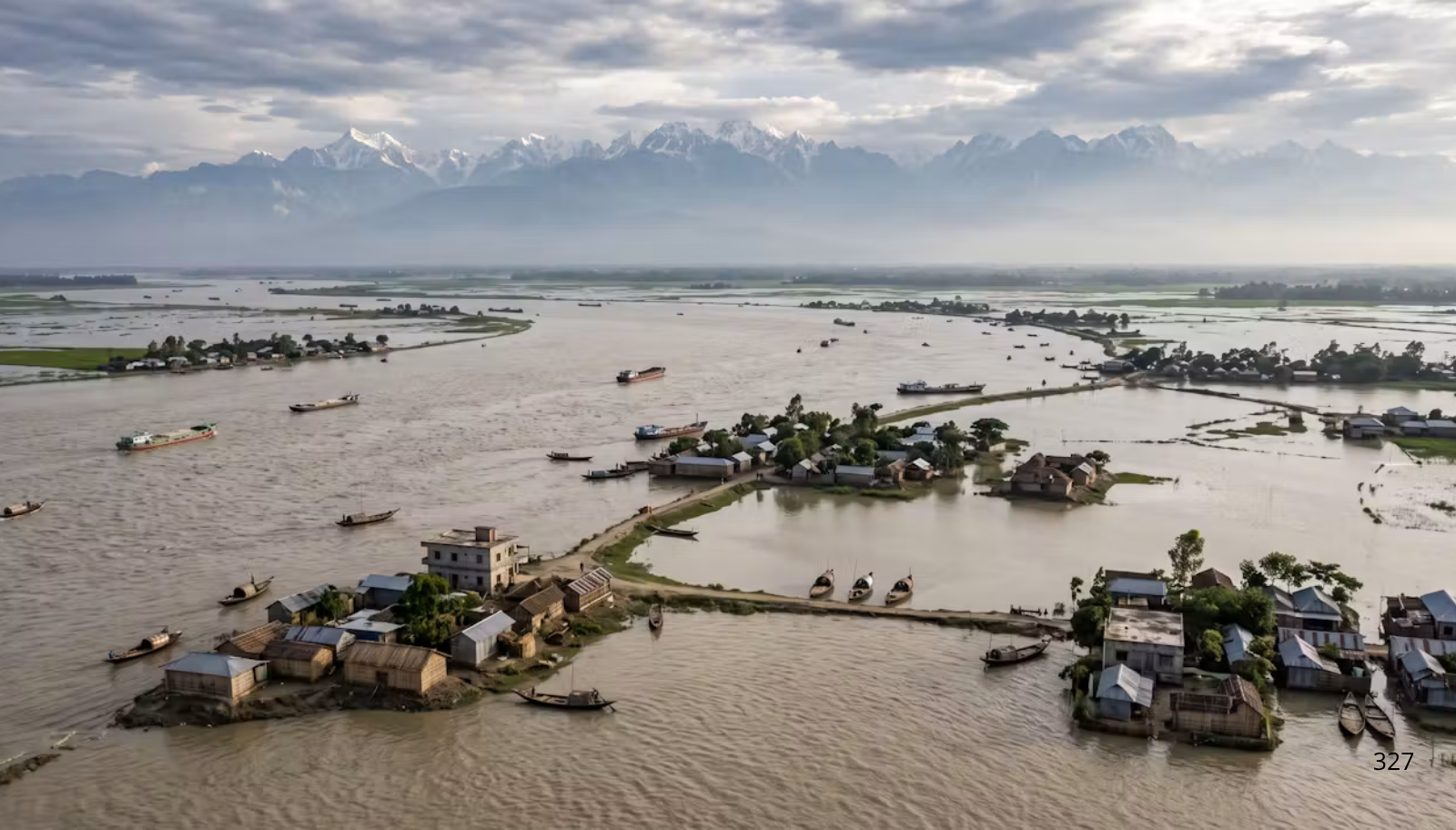
Roughly 93 percent of Bangladesh’s catchment area lies beyond its borders, making it perhaps the most hydrologically exposed country on earth. Three major routes carry this flow inward: the Brahmaputra, called the Jamuna locally, enters from the north via Kurigram and Lalmonirhat; the Ganges, or Padma, arrives from the west through Chapainawabganj and Rajshahi; and the Meghna gathers transboundary streams like the Surma and Kushiyara from the northeast through Sylhet.
Each system draws from a distinct source. The Brahmaputra, fed by Tibetan snowmelt and Himalayan monsoon discharge, contributes the largest share of peak flood volume. The Ganges drains the western Himalayas and the Gangetic plain, while the Meghna collects heavy runoff from the Meghalaya hills and Barak basin. These rivers converge near Chandpur before reaching the Bay of Bengal, submerging much of the floodplain that makes up about 80 percent of the country’s land.
Vulnerable Regions: Where the Water Hits First and Hardest
Flood vulnerability tracks the river network with predictable severity. Kurigram, Rangpur, and Gaibandha, sitting along the Jamuna’s upper corridor, absorbs the first shock of any Brahmaputra surge, while downstream, the river’s braided channel regularly devastates Sirajganj, Bogura, and Tangail. Along the Padma, Rajbari, Faridpur, Manikganj, and Munshiganj remain constantly exposed.
The Meghna’s haor districts, Sunamganj, Sylhet, Habiganj, and Netrokona, sit in bowl shaped terrain where water gathers fast and drains slowly. Southwestern Khulna, Bagerhat, and Satkhira face a compound threat, riverine flooding combined with tidal surges and saltwater intrusion. All these zones share aggraded riverbeds that have lost capacity, forcing water to spread across inhabited land.
Riverbed Aggradation and Riverbank Collapse
Bangladesh’s riverbeds and riverbanks face severe, compounding stress. Himalayan rivers carry over a billion tonnes of sediment annually across the Ganges, Brahmaputra, and Meghna, depositing it as gradients flatten entering the delta. This constant aggradation lifts riverbeds above the surrounding floodplain, turning rivers into elevated channels prone to overflow. The Jamuna alone carries roughly 500 million tonnes yearly, its shifting, braided form a direct symptom of this overload.
Erosion along the Padma, Jamuna, and Meghna has consumed thousands of hectares of farmland, destroyed infrastructure, and displaced millions. The Padma’s westward drift has swallowed settlements in Manikganj and Faridpur, while the Jamuna erodes an estimated 3,000 to 5,000 hectares yearly. When events like glacial lake outburst floods send abnormal pulses down these strained channels, already saturated banks offer little resistance, and the resulting collapse is sudden and irreversible.
The Rural Population in the Path
Bangladesh’s rural population accounts for roughly 63 percent of the total, and it is overwhelmingly this population that inhabits the floodplain margins, the char islands, and the riverbank zones that are most immediately threatened. These communities are not merely exposed to periodic inundation; they face systemic displacement through erosion, loss of agricultural land, destruction of homesteads, and the collapse of rural infrastructure.
Displaced by riverbank erosion, many migrate to urban slums or are pushed into wage labor without safety nets. The char dwellers of Rangpur and Kurigram, the haor farmers of Sunamganj, and the deltaic fishing communities of Khulna share a common vulnerability: they live where the water arrives first, where the riverbank is closest, and where the state’s protective infrastructure is weakest.
Precautionary Measures: What Must Be Done Now
Bangladesh needs a transboundary early warning system built with Nepal, India, and China, specifically calibrated for glacial lake outburst floods and ice avalanches rather than ordinary rainfall forecasting, since existing systems cannot flag a mountain collapse happening on a clear day.
Riverbank protection should be scaled up using geo textile reinforced embankments, permeable channel stabilization, and bioengineering approaches like vetiver and bamboo plantations, since concrete barriers merely push erosion downstream while flexible, permeable structures absorb energy more effectively. Dredging programs need to expand to match actual sediment accumulation, restoring depth and capacity at critical confluence points such as Bahadurabad, Hardinge Bridge, and Bhairab Bazar.
Hazard mapping requires updating with high resolution satellite data to catch newly forming glacial lakes and unstable upstream slopes, with findings shared through a regional data protocol rather than held nationally. A national policy on riverbank erosion displacement should guarantee planned relocation, livelihood rehabilitation, and land compensation for rural families before they’re pushed into urban destitution.
Haor embankments across the Sylhet basin need reinforcement with gated regulators enabling controlled drainage, since attempts at total containment tend to fail catastrophically. The Himalayas are not waiting for policy papers to catch up. The next flood pulse may already be forming in the cryosphere, and Bangladesh cannot afford to respond only once the water has arrived.
Reference: